COASTAL SALTMARSH
LOCAL BIODIVERSITY ACTION PLAN
Links to associated SAPs
None
 Current Status
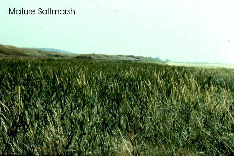
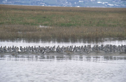
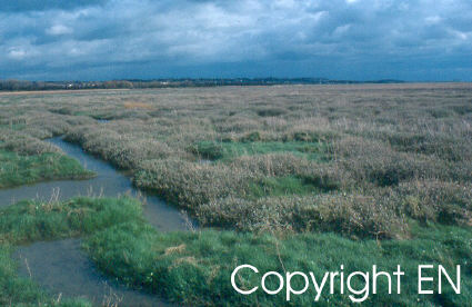
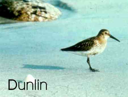
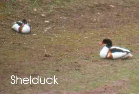
Coastal saltmarshes comprise the upper, vegetated portions of intertidal mudflats. Saltmarshes are usually restricted to comparatively sheltered locations in estuaries, saline lagoons, behind barrier islands, at the heads of sea lochs and on beach plains. The development of saltmarsh is dependent on the presence of mudflats. Saltmarsh vegetation consists of a limited number of salt tolerant plants adapted to regular immersion by the tides. At the lowest level pioneer plants can withstand up to 600 immersions per year where the upper saltmarsh can only tolerate a few tides per year. Saltmarsh communities are affected by many factors such as climatic differences from west to east, sediment types, decreasing salinities and land management. For example, on traditionally grazed sites, saltmarsh vegetation is shorter and dominated by grasses. Saltmarshes on the west coast tend to differ in species and community composition from those on the east coast. Saltmarshes are a very important habitat for plant species and a resource for wading birds and wildfowl. Acting as high tide refuges for waterfowl, breeding sites for terns, gulls, waders and passerines (skylark and meadow pippit) in autumn and winter. In winter, large flocks of swans, geese and ducks rely on saltmarshes. They provide an exhilarating and evocative landscape and seascape.
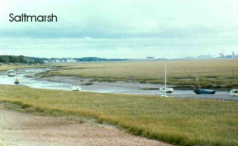
The most recent saltmarsh surveys (1989) estimate the total extent of saltmarsh at 45,000 ha. England has approximately 32,000 ha, Scotland 6,747 ha, Wales 6,089 ha and Northern Ireland 215 ha. This resource is mainly found in the major estuaries of north-west England and Wales. It is estimated that at the mean high water mark, 24% of the English coastline, 11% of the Welsh coastline and 3% of the Scottish coastline consists of saltmarsh. In Wirral, the majority of coastal saltmarsh is found in the Dee Estuary between Parkgate and Heswall. Small areas occur at West Kirby and at New Ferry on the Mersey. The saltmarsh between Parkgate and Heswall is still accreting the oldest parts being over 50 years old. None of the Wirral saltmarshes are grazed. Some loss of pioneer saltmarsh occurs at West Kirby and Hoylake due to beach cleaning by WBC.
Extent of saltmarsh
Gayton/Heswall - unknown
West Kirby - unknown
New Ferry - unknown
Land ownership: between Parkgate and Heswall the saltmarsh on the Dee is mostly owned by RSPB and Wirral Borough Council. The West Kirby saltmarsh is also owned by Wirral Borough Council. The pioneer saltmarsh at New Ferry is owned by the Crown Estate Commissioners.
In Great Britain approximately 80% of the area of saltmarsh has been notified as SSSI. Atlantic salt meadows is listed as a habitat type on Annex 1 of the EC Habitats Directive. The UK Government has proposed ten Special Areas of Conservation (SACS) for their saltmarsh features. Also 27 major saltmarsh sites are included in Special protection Areas (SPAs) under the EC Birds Directive and in Ramsar sites. These include the Dee and Mersey estuaries. 100% of saltmarsh in Wirral has been notified as SSSI. All of the saltmarsh is incorporated within the two estuarine SPA/Ramsar sites.
 Threats
- Large scale saltmarsh land claim schemes are now rare but piecemeal schemes occur occasionally.
- Saltmarshes are subject to erosion and coastal squeeze. Many saltmarshes are being squeezed between eroding seaward edge and fixed flood defence walls. This process is most pronounced in south-east England. No erosion is occurring on Wirral saltmarshes, infact the opposite is occurring with the saltmarsh rapidly accreting, for example at Heswall. Saltmarshes on the Flintshire side of the estuary are rapidly eroding.
- Accretion and development of saltmarsh is occurring in places, notably in north-west England. The type of saltmarsh in north-west England differs to that found elsewhere. Accretion which occurs there will not replace that lost elsewhere. The saltmarsh is continuing to accrete on the English side of the Dee Estuary, The saltmarsh at New Ferry is in its pioneer stage.The saltmarsh is continuing to accrete on the English side of the Dee Estuary, The saltmarsh at New Ferry is in its pioneer stage.
- Changes in coast protection works, or shape of estuary from land claim, dredging or shipping channels and impact of flood defence works over many years can result in changes to the amount of sediment entering or leaving the estuary.
- The common cord grass Spartina anglica has colonised or been planted in most estuaries (to aid land claim). It can often result in a monoculture which is damaging to wildlife. However, it is dying back naturally in many estuaries and its area appears to be stabilising. Cord grass is a common feature of Wirral saltmarshes. It is continuing to spread at a rapid rate from Heswall to Gayton.
- Grazing is traditional for many saltmarshes, creating a sward which is attractive to certain species of wintering and passage waterfowl. Less intensive grazing is better for breeding waders and skylarks in spring. Grazing is not a feature of the Wirral saltmarshes which makes them unique. Un-grazed saltmarshes have an increased diversity of species and communities and are highly valued in nature conservation terms as a natural habitat.
- Oil pollution. With the continued expansion of the gas and oil industry in Liverpool Bay, oil pollution is a continual threat.
- Landfill
- Barrage construction
- Turf cutting
- Agricultural improvement and nutrient enrichment from sewage and agricultural run-off of fertilisers.
- The West Kirby saltmarsh is under pressure from increased recreational activities and beach cleaning operations, and the New Ferry saltmarsh from fly tipping
- Development. A proposed marine lake would have totally destroyed the New Ferry saltmarsh.
How are we helping to conserve Coastal Saltmarsh in the Cheshire region?
- The UK Government has set out its commitment to sustainable management of the coast in a number of publications. These include: PPG20, MAFF's Strategy for Flood and Coastal Defence, and DETR's Coastal Zone Management - Towards Best Practice.
- DETR's Coastal Forum was established in 1994. EN has its Estuaries Initiative. Agri-environment schemes include options to re-create saltmarsh behind sea walls and saltmarsh management options.
- EA promotes the role of saltmarshes in reducing wave energy, leading to saltmarsh creation schemes.
- The Joint Nutrient Study sponsored by DETR and MAFF, highlighted the importance of intertidal areas in controlling nutrient levels.
- The pioneer saltmarsh at New Ferry has recently been notified as part of the New Ferry SSSI.
- The RSPB owned saltmarsh at Gayton/Heswall is managed as a Nature Reserve. A management plan has been produced. Reserve saltmarsh is left to natural vices and is wardened as a sanctuary area.
- The south-eastern edge of the WBC owned saltmarsh is shot by the Dee Wildfowlers Club under a licence agreement. It is important that the rest of the WBC saltmarsh is maintained as a sanctuary for the internationally important wader roost.
- The Dee Estuary is a proposed SAC.
- EN and CCW have recently carried out an NVC survey of the Dee saltmarshes. In the near future, EN are planning to carry out an NVC survey of the Mersey saltmarshes which will include New Ferry.
- Avoidance of disruption to natural coastal processes during design and implementation of coastal protection works.
- Promotion of targets in Wirral BAP to ensure integration with estuary management partnerships and other programmes and initiatives.
- Highlighting the importance of this habitat in interpretive material.
Objectives, Targets and Actions
OBJECTIVES |
LOCAL TARGETS |
1. The overall objective is to maintain, in favourable condition, the current extent of saltmarsh in Wirral. Further, to allow natural succession of saltmarsh to continue with the minimum of human interference.
2. Maintain the quality of the existing resource in terms of community and species diversity. Where necessary, restore the nature conservation interest through appropriate management. |
1. Monitoring of the extent and quality of the saltmarsh to be carried out every five years |
ACTIONS REQUIRED |
- Develop a policy for Spartina anglica on an estuary-wide basis by 2005.
- Develop agreed policies and management schemes for Wirral's beaches by end of 2003.
- Prepare and implement management plans for saltmarshes to implement these targets by end of 2003.
- Prepare information to enable current and future areas of saltmarsh and NVC communities to be digitised by end of 2003
- Monitoring of the extent and quality of the saltmarsh needs to be carried out every five years.
- Encourage a research project to look at the Dee sediment budget.
|
 |
 |
Progress so far
| 1997- 2006 Action Completed |
- NVC of Mersey saltmarshes carried out by end of 2001
|
How to find out more about Coastal Saltmarsh
This plan is part of the Wirral Biodiversity Action Plan which can be viewed at www.wirral.gov.uk/ed/biodiversity/home.htm
UK BAP for Coastal Saltmarsh - www.ukbap.org.uk/UKPlans.aspx?ID=33
Contact details
| LBAP Chair |
Colin Wells, RSPB Burton Point Farm,
Station Road, Burton,
Wirral CH64 5SB.
0151 336 7681 |
| National Lead Partners |
Environment Agency
|
| National Contact |
Duncan Huggett , Environment Agency |
References & Glossary
HMSO (1995): Biodiversity: The UK Steering Group Report, Volume 1: Meeting the Rio Challenge, London.
HMSO (1995): Biodiversity: The UK Steering Group Report, Volume 2:Action Plans, London.