COASTAL AND FLOODPLAIN GRAZING MARSH
LOCAL BIODIVERSITY ACTION PLAN
Links to associated SAPs
Mud Snail
 Current Status
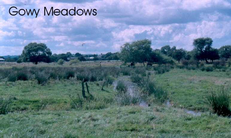
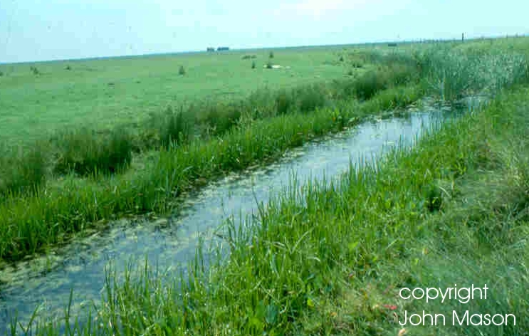
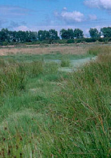
Grazing marsh is described as periodically inundated pasture or meadow with ditches which maintain the water levels, containing standing brackish or fresh water. The ditches are especially rich in plants and invertebrates.
The exact extent of grazing marsh in the UK is not known, but it is possible that there may be a total of 300,000 ha. The Cheshire region has large areas that were once naturally inundated by both sea and fresh water. However, the demands of industry and the perceived need for improved agricultural land has led to the drainage of non-coastal areas along rivers whilst sea defence works for land gain have caused the loss of coastal grazing marsh. The only specific grazing marsh site within the Cheshire region with legal protection is Meols Meadow SSSI on the Wirral Peninsula, which covers 7.1ha.
A costed Action Plan for Coastal and Floodplain Grazing Marshes is included in the UK Steering Group Report (1995).
Threats
- Ecologically insensitive flood defence works.
- Agricultural intensification.
- Industrialization.
- Groundwater abstraction.
- Pollution of groundwater or surface water.
- Neglect in traditional use
How are we helping to conserve grazing marsh in the Cheshire region?
- Grazing marsh is one of the habitats being targeted for grant aid through Countryside Stewardship.
- A Water Level Management Plan (1997) has been prepared by the Environment Agency for the Gowy meadows and ditches SBI.
- Statutory protection of the habitat through SSSI and RAMSAR designation and ESA notification.
- Liverpool Bay Natural Area Profile (EN1998) includes a section on grazing marsh.
- The RSPB is targeting advice to landowners re: wet grassland restoration initiatives.
Objectives, Targets and Actions
OBJECTIVES |
LOCAL TARGETS |
To take control of the water levels at Gowy Meadows. |
Insert sluices. |
ACTIONS REQUIRED |
| Further rush topping and an increase in the area grazed by the Longhorn cattle |
Progress so far
| 2006 Action Completed |
- Further fencing and ditching took place at Gowy Meadows.
- The main sluice was heightened and water backed up slowly throughout the Autumn.
- Sluice boards were then slowly lowered during the Spring.
- Approximately 80 acres of rush have been cut to monitor grazing on cut pasture with Longhorn Cattle that have been introduced onto the site.
|
| 2005 Action Completed |
- Further fencing and ditching took place at Gowy Meadows. 31km of fencing has been erected, 8.5 km of ditches dredged and 8km of hedgerows reinstated.
- The main sluice was heightened and water backed up slowly throughout the Autumn. Sluice boards were then slowly lowered during the Spring.
- Approximately 40 acres of rush have been cut to monitor grazing on cut pasture with Longhorn Cattle that have been introduced onto the site.
|
| 2004 Action Completed |
- Further fencing and ditching took place at Gowy Meadows in 2004
|
| 2003 Action Completed |
- In 2003 CWT started work at Gowy Meadows under DEFRA's Countryside Stewardship Scheme re-instating ditches and fencing off against livestock. Stocking rates have also been revised as have the stock types with all horses and sheep removed. In total 9148 metres of fencing was erected and 2319 metres of ditch cleared.
|
1997- 2003 Action Completed |
- Phase I habitat; breeding birds; hedgerows; invertebrates (aquatic and terrestrial) and water vole survey undertaken by Cheshire Wildlife Trust for the Environment Agency
- CWT took on a 25 year lease of the Gowy Meadows on 1.9.2001. CWT successfully applied for Countryside Stewardship for the site in 2002. CWT have implemented the Countryside Stewardship grant. 11km of fencing and 2 km of ditching work took place in 2002. Grazing pressure has been substantially reduced and surveying and monitoring efforts increased.
- MSc Project carried out by Charlotte Murray (Liverpool University) entitled "Gowy Meadows a haven for Water Voles? ", investigating the effects of the implementation of the proposed water level management plan on the water vole population.
- Invertebrate monitoring has continued on Gowy meadows.
- MSC project started on Aquatic macrophytes and beetle assemblages on Gowy Meadows.
- Survey of small mammals on Gowy Meadows in August 2002.
- Bird survey continuing on Gowy Meadows.
- CWT carried out a survey of the Shell owned area of Gowy Meadows during summer 1999.
|
How to find out more about Coastal and Floodplain Grazing Marsh
The Wirral Biodiversity Action Plan for coastal and floodplain grazing marsh can be seen at www.wirral.gov.uk/ed/biodiversity/cfgm.htm
UK BAP for Coastal and Floodplain Grazing Marsh - www.ukbap.org.uk/UKPlans.aspx?ID=9
Contact details
| LBAP Chair |
Jacki Hulse, Cheshire Wildlife Trust
Phone: 01948 820728 |
| National Lead Partners |
Natural England
|
| National Contacts |
Roger Meade, Natural England
Phone: 01733 455565
Rebecca Longfield, Faber Maunsell
Phone: 01733 391456 |
References & Glossary
RSPB, EN, ITE (1997): The Wet Grassland Guide: Managing floodplain and coastal wet grassland for wildlife.
Burgess, N. D. & Harons, G. J. M. (1990): Techniques of hydrological management at Coastal Lagoons and Lowland Wet Grasslands on RSPB reserves, RSPB.
Harley, J. B. & Laxton, P.: A Survey of the County Palatine of Chester
Burdett, P. P. (1777): The Historic Society of Lancashire and Cheshire
HMSO (1995): Biodiversity: The UK Steering Group Report, Volume 1: Meeting the Rio Challenge, London.
HMSO (1995): Biodiversity: The UK Steering Group Report, Volume 2:Action Plans, London.
EN: Liverpool Bay Natural Area Profile